Can a friendly haunted town turn map-reading into meaningful learning? For children ages 5–7, designing a Halloween neighborhood can make landmarks, symbols, routes, and spatial relationships concrete and memorable. Try ChildCareEd’s Haunted Neighborhood Map Quest Buy Now $0.00 for ready-to-use route-following and map-design activities, and explore Early Mathematics Through Play Buy Now $24.00 to deepen your strategies for teaching spatial reasoning through hands-on experiences.
Why does a Halloween map make spatial learning matter?
Maps help children represent and think about places they know or imagine. When kindergarteners create a pretend neighborhood with a pumpkin shop, park, bridge, houses, and friendly ghost garden, they practice more than seasonal art: they are translating a three-dimensional idea of place into a two-dimensional representation. That shift invites them to consider position, distance, pathways, and how one location relates to another.
Spatial thinking is foundational to later learning in mathematics and other fields. Children strengthen it when adults support them in visualizing objects and routes, using spatial language, and reasoning about how locations fit together. As the Education Development Center explains in its discussion of spatial thinking, young children can develop spatial knowledge through purposeful experiences with teachers and families.
For providers, a seasonal map quest is a practical way to turn children’s excitement into purposeful exploration. It can also invite collaboration: one child may draw a road, another may choose a landmark, and a third may explain how to travel between them. Treat each child’s map as a meaningful attempt to represent ideas, not as a test of drawing accuracy or compass knowledge.
How do landmarks and symbols help children read a map?
Landmarks give children recognizable reference points. A bridge, café, park, or unusual house can help them answer “Where are we?” and “What is near the pumpkin shop?” A map symbol is a picture or mark that stands for a place or feature. Connecting a tiny tree drawing to a park, for example, helps children understand that maps communicate information through simplified representations.
Begin with a small, familiar set of places. Invite children to select symbols together and add a map key, or legend, that explains each one. The key turns symbols into a shared code that children can consult while following a route or describing their own design. The Illinois Early Learning Project’s guidance on maps and young children recommends starting with familiar spaces and attending to location, pathways, landmarks, and spatial vocabulary.
- Choose three to six landmarks that children can easily distinguish.
- Make symbols visually clear and consistent; use a few colors or simple drawings.
- Ask children to explain their choices: “What does this little cat stand for?”
- Compare the symbol with the place it represents, using pretend objects or blocks if helpful.
Children may initially use a drawing as a picture of the whole scene rather than a bird’s-eye map. That is a productive starting point. Model looking down at a classroom or town from above, then invite children to decide how their symbols might show the same places.
How can route-following teach direction and spatial language?
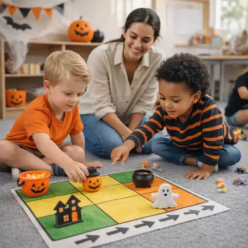
A route-following challenge gives children a reason to interpret the map. Start with short, direct directions between familiar landmarks: “Go from the house to the park,” or “Travel across the bridge and stop at the pumpkin shop.” Invite children to trace the route with a finger, move a toy along the path, or describe each step aloud. This connects what they see on paper to movement through an imagined space.
Use location words naturally as children explore: beside, between, across, near, far, above, and below. Add left and right when children are ready, but do not rush to formal cardinal directions if the immediate goal is understanding relative location. Everyday conversations about where landmarks sit on the map make vocabulary useful rather than abstract.
- 🧭 Invite children to give a partner one clear direction at a time.
- Use a small character token so children can physically move along a route.
- Ask, “What landmark will you pass before you reach the garden?”
- Let children invent a route and explain how a visitor could follow it.
Children may need to rotate or reorient a map to match their perspective. That can be challenging, so offer gestures, modeling, and time to try again. The aim is not speed; it is to help children connect a drawn path with a sequence of locations and movements.
How can children design an imaginary neighborhood map?
Mapmaking extends reading into planning and communication. Provide paper, crayons, cut-out roads, blocks, or reusable picture pieces. Ask children what places belong in their Halloween neighborhood and how a visitor might travel between them. Children can create a road layout, place landmarks, choose symbols, and make a legend. A printable resource such as Design Your Own Spooky Town Buy Now $0.00 offers a structured starting point while leaving room for children’s ideas.
As children build, encourage them to explain relationships rather than simply name objects: “The ghost garden is behind the houses,” or “The bridge connects the park to the café.” These descriptions show how children are organizing their mental picture of the neighborhood. Adults can add precise language and ask open questions without taking over the design.
- Start with a shared class map, then offer time for individual or small-group designs.
- Keep the number of places manageable; add new landmarks as interest grows.
- Invite children to use blocks or toy figures to check whether their routes make sense.
- Ask children to present one feature and explain how to find it.
Map design also creates a natural bridge to storytelling and dramatic play. Children might plan a trick-or-treat route, give directions to a visitor, or narrate a character’s journey. The map becomes a tool for expressing an idea, not merely a finished product for display.
How can providers scaffold, adapt, and observe map learning?
Begin with observation: notice whether a child identifies a landmark, matches a symbol to its meaning, follows a route, or uses words to describe position. Build on what the child already demonstrates. If route directions feel difficult, shorten the path or place a toy on the starting point. If drawing is a barrier, offer stickers, picture cards, blocks, pointing, or verbal description.
Make participation accessible to children with different communication, language, motor, and sensory needs. Pair spoken directions with pictures or gestures; accept pointing, AAC, home-language responses, and movement as valid ways to show understanding. Invite collaboration without requiring every child to perform the same task in the same way. Use encouraging prompts such as “Show me how you know the café is near the bridge.”
Avoid common pitfalls: too many landmarks at once, directions with several steps before children are ready, or correcting every map until it resembles an adult’s version. Keep the challenge playful and developmentally appropriate. Children ages 5–7 vary in experience and readiness, so adjust the supports and complexity rather than expecting identical results. If adapting a classroom activity affects safety or supervision practices, state requirements vary - check your state licensing agency.
For additional professional learning, providers may explore Math Foundations in Early Childhood  Buy Now $16.00, The Best Promotion is Play Buy Now $24.00, and Lesson Planning for Preschoolers Buy Now $24.00. These English-language courses offer broader strategies for playful learning, early math, and developmentally appropriate planning.
Conclusion: Can Halloween activities help children learn map skills?
Yes. A Halloween neighborhood map can give kindergarteners an engaging context to recognize landmarks, interpret symbols, follow routes, and describe where places are in relation to one another. The seasonal theme captures interest; the learning comes from children making, reading, discussing, and revising their maps.
Keep the experience hands-on and flexible. Start with a few familiar landmarks, use a clear legend, give short route directions, and invite children to design and explain their own neighborhoods. Notice multiple ways children show what they understand, and scaffold with language, visuals, movement, and manipulatives. With thoughtful support, an imaginary haunted town becomes a lively setting for developing #spatial #thinking, #directions, #landmarks, and #symbols—skills children can carry into everyday maps and places.
- 45 Hour Child Growth and Development
- Moving About the Classroom: Effective Transitions for Everyday
- CDA Home Visitor Subject Area 2 Part 3 Birth to 5
- Language Development in School Age
- The ABCs of Behavior: Turning Challenges into Learning Opportunities
- CDA Family Child Care Credential with Portfolio Review
- CDA: Special Needs: Understanding the Whole Child
- CDA Home Visitor Credential Birth to 5
- Mummy Races & Zombie Tag: Halloween-themed Gross Motor Games
- CDA Certification en Español: Recursos y Consejos para Educadores Bilingües
- Ready, Set, Kindergarten!
- ¿Cómo hacer actividades navideñas inclusivas para todas las familias?
- Halloween Classroom Activities Kids Will Go Batty For
- Actividades de Fiesta para Niños de Preescolar y Primaria
- Cómo Trabajar en el Cuidado Infantil en Carolina del Norte: Requisitos y Pasos
- Celebrando la amistad en el cuidado infantil durante el Día de los Mejores Amigos
- Canciones, juegos y preguntas de círculo para niños
- How can providers and families keep children safe while trick-or-treating?
- What are safe, engaging non-candy Halloween ideas for daycares?
- How Can Halloween Fine-Motor Activities Be Fun Without Being Scary?
- How Can Flag Design Help Children Explore Symbols, Patterns, and Individual Expression?
- How Can Sorting Help Kindergarteners Understand Odd and Even Numbers?
- How Can You Plan October Classroom Activities for Children Who Do Not Celebrate Halloween?
- What Should You Do When a Child Finds a Halloween Activity Frightening?
- How Can Teachers Support Children’s Emotional Development During Halloween?
- How Can Preschool Teachers Encourage Sharing and Cooperation During Halloween?
- How Can Child Care Providers Use Positive Guidance During Halloween?
- Can Halloween Activities Help Kindergarteners Learn Directions and Map Skills?
